
How Land Surveying Helps Builders Plan Around Poor Drainage Areas
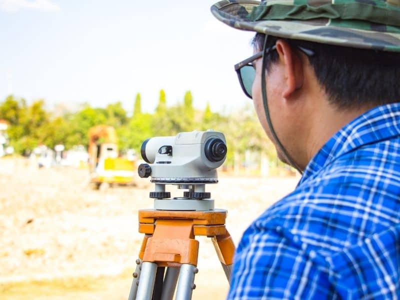
On August 14, 2026, the National Weather Service in Birmingham put central Montgomery County under a flood advisory, warning of minor flooding in low-lying and poor drainage areas as heavy rain from thunderstorms moved through. That kind of alert is a good reminder for anyone building here. Water finds the low ground fast, and it doesn’t care what the plans say. Land surveying gives builders a measured look at that ground before the big construction choices get locked in. It doesn’t stop the rain or promise a dry site. It tells the project team what the ground actually does, so they can plan with real numbers instead of a hunch.
Rain like this is normal for the area. Montgomery sees about 53 inches in an average year, which puts it among the wettest parts of Alabama. On a site that gets that much water, small differences in the ground can change where it pools and where it runs off. A survey shows those differences long before the first machine shows up.
Reading the Ground Beyond What Looks Flat
A lot can look flat when you walk it. Your eye smooths out the little dips and rises, and a cleared field can seem even from one side to the other. The ground rarely is. A drop of a few inches across a wide area is hard to see but easy to measure.
That gap between what a builder sees and what the survey measures matters. A surveyor shoots elevations across the site and turns them into real values you can compare point to point. Now the team knows the corner near the road sits lower than the back of the lot, or that one side of a planned building pad falls away more than expected. You can’t get that from a walk-through. You get it from numbers tied to the actual ground.
Finding the Low Spots That Deserve a Closer Look
Once the elevations are down, the low areas stand out. These are the spots where the ground sits lower than the land around it, the small pockets and shallow bowls that a survey can pin down by location and depth.
A low spot is worth a second look, especially when a foundation, driveway, building pad or other improvement is planned near it. It’s a flag, not a verdict. A low area is not proof that water will collect there. Whether it actually holds water depends on the rain, the soil, the grades around it and whatever drainage already runs through the site. The survey does one job well here. It shows the team where the dips are, so those spots can get the attention they may need before anything gets built.
Giving Builders Reliable Ground Information Before Grading
This is where a survey earns its keep for a builder. Before anyone moves dirt, the survey gives a clear record of what the ground looks like right now. The existing elevations across the site. Where the grade changes and how sharply. Where the main features sit. How the planned building areas line up with the ground as it stands today.
That information goes to the designer or engineer as a starting point. They can see how the proposed work relates to the real surface and where the plan and the ground don’t match yet. Better site information before grading means fewer surprises later. When a crew starts cutting and filling with a solid picture of the original ground, there’s less guesswork and less chance of a costly redo once the equipment is already on site.
Recognizing Where Water Already Has a Path
Many sites already show signs of how water moves across them. Field crews can spot and record features that hint at existing flow. A shallow swale running along one edge. An old ditch. A culvert under a drive. A pipe, a channel or another feature built to carry water from one place to the next.
When these features fall within the scope of the work, the surveyor records where they sit and how the ground shapes them. That gives the team a clearer read on the site before construction changes the landscape. One thing a survey doesn’t do is judge how well those features work. A surveyor can show that a ditch or culvert is there and where it runs. Whether it can handle a given flow is an engineering question, and that belongs to the right professional.
Using Survey Information to Make Better Site-Planning Decisions
Good ground information helps the team ask the right questions early. Does a planned building area sit near a low spot that deserves more review? Is there an existing drainage feature the design needs to work around? These are far easier to raise before construction than after.
One boundary is worth keeping clear. A land survey gives measured facts about the site, the elevations, the grades and the features that are already there. Engineers and other qualified professionals take that information, add their own analysis, and work out the drainage, grading or stormwater plans when a site needs them. The survey is the source of good ground information. The design decisions built on it belong to the people trained to make them. Builders who start with accurate ground data give their whole team a better shot at getting those decisions right.
Frequently Asked Questions
Can land surveying show where water tends to collect on a building site?
A survey can point out the low areas and measured elevations that may play a role in how water moves. It marks the spots worth watching. It doesn’t predict every flooding condition on its own, and it doesn’t take the place of a real drainage study.
Why should builders look at existing ground conditions before grading?
The current elevations give a solid baseline for seeing how planned work fits the site as it is now. With that in hand, the team can catch areas that may need a closer look before any dirt gets moved, which costs a lot less than fixing them mid-job.
Can a survey identify existing drainage features?
Yes, when it falls within the agreed scope. A survey can record visible features like ditches, swales, culverts and similar improvements and show where they sit. It stops short of deciding whether a drainage system has enough capacity, since that call takes an engineering review.
