An owner’s idea and a finished building are separated by dozens of people who never met each other. Construction survey information is one of the few things that connects all of them, and on projects where multiple trades are working at the same time, that connection does more work than most people realize until something goes wrong without it.
A Project Stops Being Personal Once More People Begin Building It
Every project starts as someone’s idea. A business owner pictures a building. A developer draws a plan. A homeowner describes what they want to a designer. At that point, the project belongs entirely to one person’s vision, and any decision can be made by asking that person what they want.
Then the teams arrive. A site crew starts grading. A foundation contractor reads the plans. A concrete crew pours based on the layout marks in the ground. A framing crew builds from what the foundation gives them. None of these groups share a brain. They share drawings, instructions and field marks, and they each interpret those things through their own experience. The original vision is still there, but it now has to survive contact with many different sets of hands, all working from their own piece of the picture.
This shift happens on every project, and most people involved in construction have seen what happens when that transition from personal vision to shared execution goes poorly. The project drifts in small ways. A wall ends up a foot off. A utility trench cuts through where a foundation will sit. A driveway approach doesn’t line up with the road connection the next crew assumed it would. Each of these problems started as a gap in shared reference, not a gap in effort or skill.
Good Intentions Need More Than Good Communication
Everyone on a well-run job site wants the project to succeed. That’s not the problem. The problem is that wanting the same outcome and working from the same information are two very different things, and construction has a way of revealing that difference at the worst possible moments.
A grading crew that understands the design intent perfectly can still place a pad in the wrong elevation if the reference point they’re using drifts after a rainstorm shifts the stake. A foundation crew with years of experience can build a perfect foundation in the wrong location if the layout marks feeding their work came from a calculation error made three days earlier. These problems don’t come from carelessness. They come from the gap between what each team assumes they know and what’s actually been verified.
Good communication moves information between people. It doesn’t verify that the information is correct. That’s a different job, and it belongs to construction survey.
Progress Depends on What Everyone Can Agree On
When several teams are working toward the same project, the one thing they all need is a shared set of facts about where they are and where things need to go. Not a shared attitude. Not a shared work ethic. Shared facts, specifically about position and elevation, that everyone can measure from and trust.
Without that shared foundation, each team builds its own version of reality from the reference points closest to it. Those versions usually agree on most things. But they don’t agree on everything, and the places where they diverge become the problems that slow projects down and cost money to fix.
This is why construction survey information matters more as project complexity grows. On a small single-trade project, one person can hold the whole layout in their head and catch inconsistencies by observation. On a project with five active trades, that doesn’t work. The information has to live somewhere that every team can access and trust, and verified survey data is the most reliable version of that.
Construction Survey Information Keeps Separate Efforts Pointing in the Same Direction
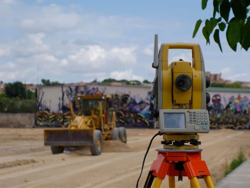
Here’s what a construction survey actually does on a multi-team project. It establishes verified positions and elevations on the ground before work begins, and it maintains those references throughout the job so that each trade can check its work against something that doesn’t change based on who measured last.
A foundation crew working from those references builds to the right position. A structural crew that follows builds from a foundation that’s where the plans say it should be. Utility connections meet the building where the design expected them to meet it. Paving and site work close out against grades that were set correctly from the start. Each trade does its part, and the parts fit together because they were all measured from the same verified starting point.
On projects where that shared reference is strong, the handoffs between trades are smooth. When one crew finishes, the next crew finds what it expected to find. That sounds simple. On a complicated site with many teams and a tight schedule, it’s one of the harder things to achieve and one of the most valuable.
The Best Projects Feel Simple Even When Hundreds of Decisions Are Involved
A well-built project doesn’t look complicated when it’s done. The walls are where they should be. The site drains the way it was designed to drain. Everything fits. From the outside, that result looks like it came together easily, and sometimes people assume it did.
What they’re not seeing is the number of times during construction that a measurement was verified before work continued, that a position was checked against a control point before concrete was poured, that an elevation was confirmed before a grade was set. Those checks don’t show up in the finished product. They show up in the absence of problems, and the absence of problems is exactly what a project is supposed to look like when it’s done right.
Construction survey is a large part of what produces that absence. It’s the shared reference that hundreds of decisions get made against, and the reliability of those decisions is what determines whether the finished project matches the original vision or falls short of it.
Frequently Asked Questions
Why do construction projects involve so many different teams?
Modern construction requires specialists with different skills for different phases of the work. Grading, foundation, framing, utilities and finishing all require separate expertise, and those teams typically overlap on a busy project site.
Why can coordination become more important as projects grow?
More participants mean more opportunities for information to drift between teams. When many groups work from separate versions of the same layout, small gaps between those versions can produce costly misalignments that nobody catches until a handoff fails.
How does a construction survey support multiple teams?
Construction survey establishes verified positions and elevations on the ground that all teams can measure from and rely on. When each trade works from the same confirmed reference, the handoffs between them are more likely to go smoothly.
Is construction survey only important for large developments?
No. Any project where more than one trade works from the same layout benefits from verified reference information. The scale of the project changes the number of handoffs, but the need for shared, accurate reference points stays the same.
Why do successful projects appear simple from the outside?
Strong coordination and verified information remove most of the visible friction from construction. When each trade finds what it expected at each handoff, the work flows without the delays and corrections that make complicated projects look complicated.

 Land Surveyors are professionals who measure and make precise measurements to determine the size and boundaries of a piece of real estate. While this is a simplistic definition, boundary surveying is one of the most common types of surveying related to home and land owners. If you fall into the following categories, please click on the appropriate link for more information on that subject: