
↓
 

Montgomery Land Surveying

Land Surveying in Montgomery, Montgomery County, Alabama

Montgomery Land Surveying
  • Home
  • ALTA Survey
  • Boundary Surveying
  • Construction Survey
  • Drone LiDAR Mapping
  • Elevation Certificate
  • Land Surveying
  • Topographic Survey
  • Civil Engineering
    • Expert Witness
    • Elevation Certificate – LOMA
  • Contact Us
  • Blog
Home - Page 2 << 1 2 3 4 … 13 14 >>

Post navigation

← Older posts
Newer posts →

Why Developers Should Order a Due Diligence Survey Before Rezoning Land

Montgomery Land Surveying Posted on September 18, 2026 by MontgomeryLSSeptember 17, 2026
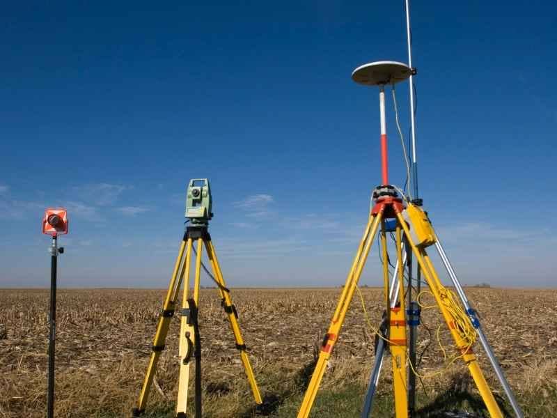
Due diligence survey equipment on development land in Montgomery, Alabama

Rezoning changes what a piece of land is allowed to become. It does not change what the land really is.

A due diligence survey fills that gap. It gives developers real, checked facts about a site. This happens before they spend time and money trying to get the land rezoned.

New buildings are spreading into new areas and older lots alike. A survey helps stop a rezoning approval that does not match what the land can really handle.

Confirming the Land Included in the Rezoning Request

A rezoning request uses a legal description of the land. That description has to match the real boundary of the land being asked about.

A due diligence survey checks this match. It checks the boundary lines. It compares the legal description to the recorded plat or deed. It flags any gaps or overlaps before the request moves forward.

This matters more than it seems. Rezoning the wrong piece of land, or a piece with unclear lines, can cause problems later. These problems often show up during permitting or building.

Many lots have been split, joined or changed over the years. Old legal descriptions do not always match the real lines today. A survey catches this early. That way, it does not become a bigger problem after approval.

Documenting Existing Conditions Before Planning a New Use

Before anyone can plan a new use for land, someone has to record what the land looks like right now. This means the shape of the ground, water flow, buildings, plants and road access.

A due diligence survey records all of this in detail. This information becomes the base for every planning choice that comes after it.

Things a survey often records:

  • Changes in height and slope across the land
  • Wet areas or drainage paths
  • Buildings, pavement or pipes already there
  • Trees and how much plant cover there is
  • Places where the land connects to nearby roads

Skipping this means planning a new use based on guesses instead of facts. That often leads to costly fixes once the project moves into design and permitting.

Identifying Site Constraints That Could Reshape Development Plans

Every piece of land has limits. Some are easy to see, like a steep hill or a creek running through the middle. Others only show up once someone looks closely.

A due diligence survey finds these limits before a developer picks a final plan. Finding a limit early gives room to change the plan. Finding it late often means starting over.

Common Limits in the Area

Flood zones affect several areas, especially near the Alabama River and the smaller streams that feed into it. Drainage easements and pipe or wire corridors also cross many lots, especially in areas built up over many years.

Why This Matters for Rezoning

A rezoning request built on a plan that ignores real limits can run into trouble. This can happen during approval or after approval, once engineering and permits start. Cities may ask for more details if these limits are not explained clearly in the request.

Supporting Concept Plans With Field-Verified Survey Data

Most rezoning requests include a concept plan. This plan shows the proposed use, layout and how much building is planned. These plans hold more weight with city planners when they come from real survey data instead of photos from the air or guesses.

Checked, real-world data makes a concept plan stronger by showing:

  • Correct boundary lines and land size
  • Realistic building areas based on the true buildable space
  • Drainage and grading plans that match the real land shape
  • Roads and paths that fit the land as it truly is

City staff and elected officials look at many rezoning requests. A plan built on real survey data tends to move through review faster, with fewer questions and delays, than one built on rough guesses.

Using Survey Findings Before Committing to Rezoning

A due diligence survey works best when done early. This should happen before a developer puts a lot of time or money into one rezoning plan.

Steps to take before filing a rezoning request:

  1. Order a due diligence survey as soon as you control or have a contract on the land
  2. Review the boundary, height and site details with your engineer or land planner
  3. Change the concept plan based on real limits, not guesses
  4. Ask the city or county if any site conditions affect the rezoning process
  5. Add survey time into your project schedule, especially if money or closing dates depend on rezoning being approved

Rules for rezoning, and how much survey detail is needed, can change based on the city, county, land type and size of the project. If your timeline depends on a certain rezoning result, check your survey needs with the city or county early.

Posted in alta survey | Tagged alta survey

What a Property Survey Can Reveal Before Buying a Vacant Lot

Montgomery Land Surveying Posted on September 11, 2026 by MontgomeryLSSeptember 9, 2026
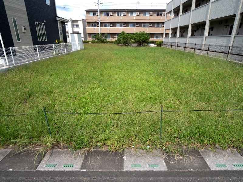
Property survey review of a vacant lot showing site conditions and development potential in Montgomery Alabama.

A vacant lot looks simple on paper. It has a shape, a size in acres, and a price. Then a property survey comes back. It shows the buildable space is only half of what the listing seemed to promise. Why? A drainage easement runs right through the middle of the lot. A setback rule also eats up more space along the road.

This happens often enough in Montgomery that smart buyers order a survey before they fall in love with a piece of land. They do not wait until they are already under contract with a closing date coming up fast. Vacant land has more unknowns than a lot with a house already on it. There is no building history to look at.

Uncovering Property Conditions Before a Vacant Lot Purchase

A property survey records the real facts about a piece of land. This includes the boundaries, the shape of the land, the ways to access it, and anything else you can see on the ground that affects how you can use the property.

For vacant land, this matters more than most people think. A lot with a house on it already shows you where the house sits, where the driveway goes, and where the utility lines connect. A vacant lot shows none of that. So the survey becomes your main source of facts about what the site can really support.

Montgomery keeps seeing steady interest in vacant lots, both inside the city and in growing areas like Pike Road and east Montgomery County. New homes and small businesses keep popping up there. Buyers in these spots often think a lot is simple because nothing has ever been built on it. But unbuilt does not mean unrestricted.

What a Basic Survey Typically Covers

A standard boundary survey or property survey shows the legal property lines, any visible spots where something crosses onto the land, and general site features. It does not always include height data, flood zone info, or a full title check. Ask your surveyor which type of survey fits what you need to check.

Identifying Boundaries, Access, and Site Limitations

Checking the boundary is the most basic job of a property survey. It matters more on vacant land than most buyers realize. Old maps, tax records and county files can be wrong or out of date. This happens a lot on lots that have been split or joined together over the years.

A survey should confirm:

  • The exact legal boundary lines, tied to real markers when possible
  • Real access to the property, including whether it faces a public road or depends on an easement
  • Any gaps or overlaps with the land next door
  • Setback rules based on current zoning
  • The shape of the land that could limit where you can build

Access is worth checking closely. A lot with no direct road access, one that depends on an easement across someone else’s land, can make things harder. It can complicate your loan, your insurance and any future building plans. Check the legal right to access the land before you assume a driveway or road frontage works the way it looks.

Reviewing Easements and Existing Property Restrictions

Vacant land often carries easements that you cannot see just by walking around. Utility companies, drainage departments and even past owners can hold recorded rights that limit what a new owner can build.

A survey can reveal common limits like:

  • Utility easements for power, water, sewer or gas lines
  • Drainage easements tied to stormwater control
  • Access easements that help a neighboring property
  • Deed rules or covenants tied to a subdivision
  • Setback lines required by current zoning that shrink the buildable space

Some of these rules come from the county or city. Others are private deals between past property owners. A survey along with a title search gives you a fuller picture than either one alone. This matters most on land that has changed owners many times.

Evaluating Development Potential With Survey Data

Once you confirm the boundaries, access and limits, survey data becomes the base for figuring out what the lot can really support. This matters whether you plan to build one home, a small group of homes, or a business.

Survey information that helps with this includes:

  • The shape of the land, showing slopes, low spots and drainage paths
  • Soil and site facts that could affect a foundation or septic system
  • The real buildable space left after setbacks and easements are taken out
  • Trees, structures or natural features that could affect your building layout
  • Utility access points and how far they are from the site

A lot that looks big on a map can shrink a lot once you account for setbacks, easements and land you cannot build on. Getting this information before you agree on a price gives you a real sense of what the land can actually support.

Reducing Purchase Risks Through Property Due Diligence

Most costly surprises on vacant land deals come from skipped or delayed checks, not bad luck. A property survey is one of the more affordable steps in the process, especially compared to the risk it helps you avoid.

Before you finish buying a vacant lot, make sure you have:

  • A current property survey showing boundaries, access and visible site features
  • A title search that finds recorded easements, covenants and restrictions
  • Confirmation of current zoning and any setback rules that apply
  • An understanding of flood zone status if the lot sits near water or low ground
  • A clear picture of utility access and what it will cost to bring services to the site

Timing matters if your purchase depends on a loan deadline or a set building schedule. Order the survey as early as you can during your check period. The results can change your bargaining power or even your choice to move forward at all. Rules and normal practices can be different depending on the county, lender and project size. Check your specific needs with a local surveyor and a real estate lawyer.

Frequently Asked Questions

Do I need a survey if the seller already has one from when they bought the lot? 

An older survey might not show current conditions, boundary changes or new easements. Ask your surveyor if the old survey is new enough to trust, or if you need an updated one for your purchase.

How long does a property survey take on vacant land? 

This depends on the size of the lot, the land shape, and whether the surveyor can find the old boundary markers. Ask your surveyor for an estimate that fits your project, especially if you have a closing deadline.

Can a property survey tell me if the lot is buildable? 

A survey gives you the boundary, access and site facts you need to check if you can build there. But a full answer often also needs a zoning check, soil testing and flood zone status. Your surveyor can tell you what other steps might apply.

Posted in boundary surveying | Tagged boundary survey

How Land Surveying Helps Builders Plan Around Poor Drainage Areas

Montgomery Land Surveying Posted on September 4, 2026 by MontgomeryLSAugust 28, 2026
Land surveying on a construction site in Montgomery, AL

On August 14, 2026, the National Weather Service in Birmingham put central Montgomery County under a flood advisory, warning of minor flooding in low-lying and poor drainage areas as heavy rain from thunderstorms moved through. That kind of alert is a good reminder for anyone building here. Water finds the low ground fast, and it doesn’t care what the plans say. Land surveying gives builders a measured look at that ground before the big construction choices get locked in. It doesn’t stop the rain or promise a dry site. It tells the project team what the ground actually does, so they can plan with real numbers instead of a hunch. 

Rain like this is normal for the area. Montgomery sees about 53 inches in an average year, which puts it among the wettest parts of Alabama. On a site that gets that much water, small differences in the ground can change where it pools and where it runs off. A survey shows those differences long before the first machine shows up.

Reading the Ground Beyond What Looks Flat

A lot can look flat when you walk it. Your eye smooths out the little dips and rises, and a cleared field can seem even from one side to the other. The ground rarely is. A drop of a few inches across a wide area is hard to see but easy to measure.

That gap between what a builder sees and what the survey measures matters. A surveyor shoots elevations across the site and turns them into real values you can compare point to point. Now the team knows the corner near the road sits lower than the back of the lot, or that one side of a planned building pad falls away more than expected. You can’t get that from a walk-through. You get it from numbers tied to the actual ground.

Finding the Low Spots That Deserve a Closer Look

Once the elevations are down, the low areas stand out. These are the spots where the ground sits lower than the land around it, the small pockets and shallow bowls that a survey can pin down by location and depth.

A low spot is worth a second look, especially when a foundation, driveway, building pad or other improvement is planned near it. It’s a flag, not a verdict. A low area is not proof that water will collect there. Whether it actually holds water depends on the rain, the soil, the grades around it and whatever drainage already runs through the site. The survey does one job well here. It shows the team where the dips are, so those spots can get the attention they may need before anything gets built.

Giving Builders Reliable Ground Information Before Grading

This is where a survey earns its keep for a builder. Before anyone moves dirt, the survey gives a clear record of what the ground looks like right now. The existing elevations across the site. Where the grade changes and how sharply. Where the main features sit. How the planned building areas line up with the ground as it stands today.

That information goes to the designer or engineer as a starting point. They can see how the proposed work relates to the real surface and where the plan and the ground don’t match yet. Better site information before grading means fewer surprises later. When a crew starts cutting and filling with a solid picture of the original ground, there’s less guesswork and less chance of a costly redo once the equipment is already on site.

Recognizing Where Water Already Has a Path

Many sites already show signs of how water moves across them. Field crews can spot and record features that hint at existing flow. A shallow swale running along one edge. An old ditch. A culvert under a drive. A pipe, a channel or another feature built to carry water from one place to the next.

When these features fall within the scope of the work, the surveyor records where they sit and how the ground shapes them. That gives the team a clearer read on the site before construction changes the landscape. One thing a survey doesn’t do is judge how well those features work. A surveyor can show that a ditch or culvert is there and where it runs. Whether it can handle a given flow is an engineering question, and that belongs to the right professional.

Using Survey Information to Make Better Site-Planning Decisions

Good ground information helps the team ask the right questions early. Does a planned building area sit near a low spot that deserves more review? Is there an existing drainage feature the design needs to work around? These are far easier to raise before construction than after.

One boundary is worth keeping clear. A land survey gives measured facts about the site, the elevations, the grades and the features that are already there. Engineers and other qualified professionals take that information, add their own analysis, and work out the drainage, grading or stormwater plans when a site needs them. The survey is the source of good ground information. The design decisions built on it belong to the people trained to make them. Builders who start with accurate ground data give their whole team a better shot at getting those decisions right.

Frequently Asked Questions

Can land surveying show where water tends to collect on a building site?

A survey can point out the low areas and measured elevations that may play a role in how water moves. It marks the spots worth watching. It doesn’t predict every flooding condition on its own, and it doesn’t take the place of a real drainage study.

Why should builders look at existing ground conditions before grading?

The current elevations give a solid baseline for seeing how planned work fits the site as it is now. With that in hand, the team can catch areas that may need a closer look before any dirt gets moved, which costs a lot less than fixing them mid-job.

Can a survey identify existing drainage features?

Yes, when it falls within the agreed scope. A survey can record visible features like ditches, swales, culverts and similar improvements and show where they sit. It stops short of deciding whether a drainage system has enough capacity, since that call takes an engineering review.

Posted in land surveying | Tagged land survey, Land Surveying

Post navigation

← Older posts
Newer posts →
Get Quote Button
© Boxer Survey USA
Montgomery Land Surveying
Montgomery, AL
Phone: (334) 625-9540

Web Development and SEO by:
AuburnBusiness.com, LLC


Privacy Policy | Terms of Use

The owner of this website, Boxer Survey USA, provides coordination of professional land surveying and engineering services in all 50 states. The professional surveying and engineering services provided to you will be conducted by fully licensed professionals in your state.

↑